Saturday, August 28, 2010
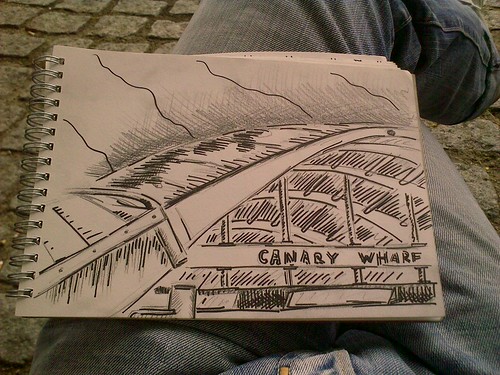
Canary Wharf
* clickable
Have visited Canary Wharf for the first time today, and was surprised that the place doesn't feel like London at all. Before I used to think that the bigger the buildings are, the nicer the city is, and hence the nicest part of the city is where it's scraping the skies, but living in London made me change my opinion which was so hard before.
Maybe it was just a weekend spoiling the impression. Crowds of people in suits surely make the space more alive.
Wednesday, August 18, 2010
"Russian Mountains"
That what is called an English leave in Russia is called a French leave in England.
Saturday, August 14, 2010
Sketching at V&A
Showers are making sketching outside almost impossible. Seems like summer is over:
Hoping for a spell of sunny weather in September though, basing on my short experience.
Friday, August 13, 2010
Thursday
Some thoughts from yesterday's life drawing session:
* clickable
First of all, charcoal is a great tool. Seriously, it's pure joy - I haven't tried it for ages and almost forgot what fun can it be. I don't know how to describe it properly to give you the right picture - but imagine that you think you can't make tone even darker for it's already RGB(0,0,0), and then you still apply few additional strokes, pressing the stick so hard to the paper that it begins to crumble, and yes, you receive the darker colour every time. Feels like magic.
The second thing is, that because of the charcoal features you find yourself no longer afraid of large formats and empty white sheets which usually scare you away when you are with your pencils only. The volumes and spaces can be toned with the charcoal in a moment, so it doesn't take long to fill all your medium.
And thirdly, the large formats that become possible to cope with proper tools available are surprisingly much more convenient when it comes to proportions which is important in life drawing. When you look at your picture from some distance and when the unavoidable aberrations in the hand-drawn line are not significant comparing to line's thickness and length, things become easier.
Resume - small formats and notebooks are good for urban sketching only. When you have an opportunity, take the A1 or at least A2 - even if the result is not so different in your case, the fun surely will be.
Monday, August 9, 2010
Achievement unlocked
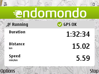
The problem is that I'm running out (no pun intended) of interesting routes. An ideal route is the one that doesn't repeat itself on the way back and provides interesting neighbourhoods or views to observe, so I can use some planning here next time.
Also, I can recommend you the Endomondo tracker app. I used Nokia Sports Tracker before but Endomondo can count kilometres/laps and say the stats when another one is hit, so you don't even have to look into screen. Very convenient.
Thursday, August 5, 2010
Monday, August 2, 2010
Making Cycle Hire easier
The TfL Cycle Hire Map recently launched is very handy but still some things could be improved - it is tricky for a casual user to get the list of the stations with their coordinates for offline use. Also, there is no visible way of importing those coordinates into a GPS navigator - you're tied to the TfL website or Google Maps in the best case. So I've done some minor scripting to retrieve the information and published it:
Using Fusion Tables, you can create your own mashups and visualizations in several clicks - e.g. you can add a map like the one below to your page (just select "Visualize" / "Map" and customize your settings):
Also, you can easily get the same table in KML format or as a plain CSV (just select "File" / "Export" to get a CSV file).
What's it all about? With the raw data received in KML or CSV form you can feed those coordinates to almost any navigation system you use with little efforts to change the format to the one your device supports.
For example, here you can download a file for Nokia OVI maps I've created in 5 minutes. To add the docking stations coordinates to your Nokia phone, you need to copy this file to your device, then install free LmManager app and use its "Import" feature to put them all into your landmarks (for some yet unknown reason they may appear uncategorised but it's a 15 seconds deal to select them all in the standard Landmarks application and categorize in a bundle).
As a result, now you can navigate to the nearest station without internet connection required.
Upd. Pay attention that these are only coordinates, with no current state information provided. If you want to see the number of bikes and docking slots available at the moment, the best map you need is here (on the contrary to the official TfL version it shows the numbers right in the marker icons).
Update: Ovi Maps pack updated.
Update: Another update
Update: for an up-to-date version please see the new dynamic solution.
Subscribe to:
Posts (Atom)